How Hard is Walking Cleveland Way?
The Cleveland Way runs for 110 miles from the market town of Helmsley in the North York Moors National Park to Filey Brig on the Yorkshire coast. The Trails Shop team discuss the difficulty of this iconic walk and provide advice on how to prepare for an adventure on the Cleveland Way.
So how hard is walking the Cleveland Way? Despite only being only 110 miles long the Cleveland Way is a real challenge. It’s one of the harder National Trails, but still one that most people can complete. There are hill climbs and lots of short, steep sections on the coast, but the views are very definitely worth it.
Is the Cleveland Way Hilly?
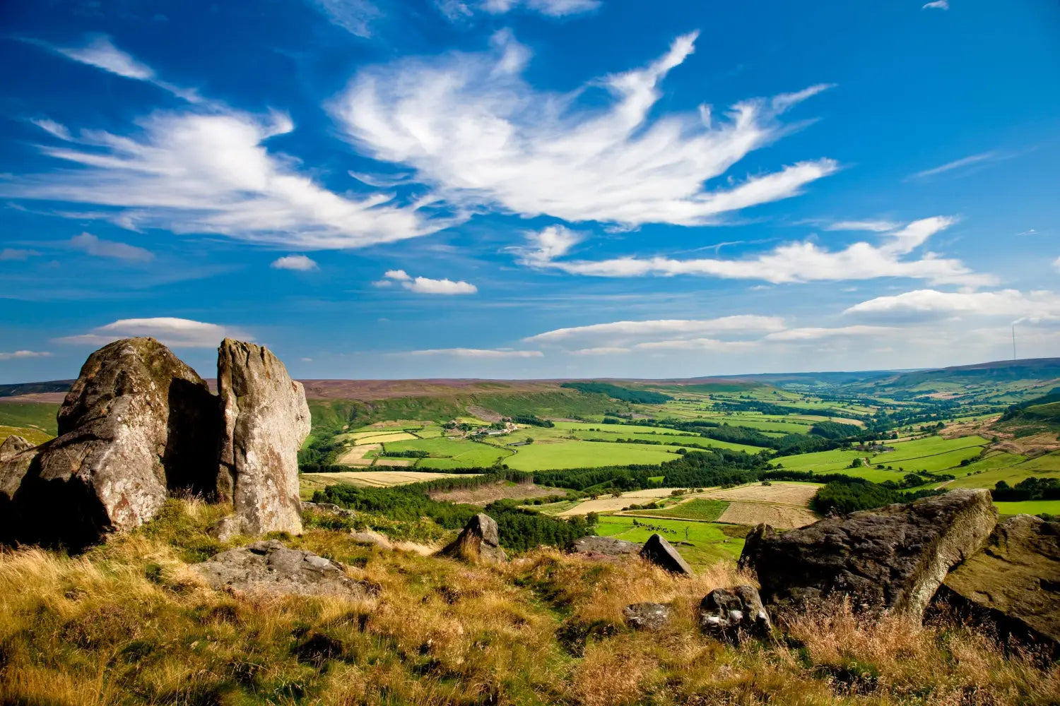
Yes! The inland section starts at Helmsley and skirts the edge of the North York Moors National Park. It includes several climbs up onto the hill tops, but once up there you are rewarded with ridge walks and spectacular views. The coastal section is less hilly, but, like all cliff-top walks, does include many places where you need to drop down to cross streams, then climb back up the other side.

None of the hills are too extreme, and anyone who is reasonably fit should be able to enjoy them and the fabulous views they provide across the moors and landscapes of the north east. The trail takes in one of the most iconic hills of the area - Roseberry Topping. This volcano-like peak has been compared to the Matterhorn, although Cleveland Way walkers will be relieved to know it is much smaller. At only 320m high when you reach the top it feels like you have climbed a real mountain, but with a fraction of the effort.

We think the Cleveland Way is one of the best National Trails - in a relatively short (110 mile) walk you pass through two completely different landscapes, the heather clad moorlands of the North York Moors National Park, with the iconic historical stone crosses, stunning views and ruined abbeys, and the beautiful North Yorkshire coast. The coastal section takes you through famous seaside resorts including Whitby and Scarborough, and charming fishing villages perched on the cliff face. Yes, it’s a bit hilly, but it is definitely worth the effort.

As this is a popular route, we recommend planning ahead. Booking accommodation in advance is essential due to the limited places especially on the coastal section and during holiday periods. There are, however, plenty of places offering food and drink so you can refresh yourself and rest at your leisure. Planning ahead and allowing time for rest stops and refreshments makes the trail much more enjoyable.
Is the Cleveland Way Well Signposted?
Yes, it is very well signposted. It is waymarked with the distinctive black and white acorn symbol that represents the National Trails. The quality of the waymarking is excellent, with many people commenting on how well the trail is signposted.

Despite this, though, we do recommend that you take an up to date map with you. We sell all of the most recent Cleveland Way maps, you can choose between the official Cleveland Way Map produced by A-Z maps, a waterproof Harvey Map, or buy the Cicerone guidebook which includes a pocket-sized Cleveland Way map and also information about the Yorkshire Wolds Way. If you fancy something different you could buy a Splashmaps fabric Cleveland Way map.
How Long is the Cleveland Way Walk?
The Cleveland Way walk is 110 miles long. The official guidebook recommends a 9 day trip, with walks of between 8 and 14 miles per day. Experienced walkers can combine days to complete the trip easily in a week or even less.. The 9 day trip does allow time to enjoy some of the historical sites along the way, and means you have time to enjoy the scenery and maybe stop for an ice cream in the coastal villages.

If you have more time, or want to walk further each day and feel the Cleveland Way isn’t long enough for you, why not add on the Yorkshire Wolds Way which ends at Filey Brigg? Simply keep going when you get to Filey, but don’t forget to buy fish and chips first.
Can You Camp Along the Cleveland Way?
There are a number of campsites along the Cleveland way, many offering glamping too. This area is popular in the summer so it is wise to book ahead. Some sites keep an area free for Cleveland Way walkers looking to camp for a night, but it is sensible to check. It is not legal to wild camp in England. If you are tempted to try to wild camp please seek the landowner’s permission, and make sure you leave no sign of your stay.
Which Direction Should You Walk the Cleveland Way?
Most people start in Helsley and walk to Filey, but there is nothing to stop you going the other way. Most of the guidebooks describe the walk starting in Helmsley, but as the trail is very well waymarked you can start in Filey and still find your way. Whichever way you choose to walk you will be rewarded with fabulous views.
In the summer you might find that starting your walk mid-week, or walking from Filey to Helmsley can make booking accommodation easier as you are not competing for a place to stay with everyone else who started at Helmsley on a Saturday.
Is the Cleveland Way Suitable for Bikes?
No - the Cleveland Way is a walking trail. The Cleveland Way follows public rights of way, most of these are public footpaths. Some small sections are on bridleways, which can be used by bikes, but these are not joined up. Bikes can use the Cinder Track, a disused railway between Scarborough and Whitby.
Cleveland Way Maps and Guidebooks at The Trails Shop
We sell the full range of Cleveland Way maps and guidebooks. We always sell the most up to date versions. You can see our range of maps and guidebooks along with Cleveland Way merchandise here.
Cleveland Way Merchandise The Trails Shop
At The Trails Shop, we are passionate walkers who care about creating long lasting memories. Our extensive Cleveland Way collection includes convenient maps and guidebooks, covering the entire route or individual sections to keep you on track.
Show your support for National Trails by wearing one of our Sew-on Badges or commemorate your achievement with a Completion Certificate. For more information about the incredible Cleveland Way, check out our Trail Information page